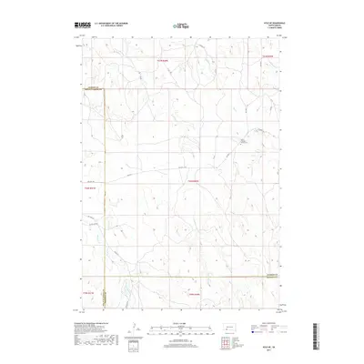
2017 Map of Kyle NE
USGS Topo · Published 2017About this map
Lakota Freedom Veterans Cem stands as a central landmark in this 2017 survey of the plains northwest of Kyle. The landscape is defined by the drainage systems of Redwater Cr and Bull Cr, which carve through the high prairie of the Pine Ridge Reservation. This area represents a critical intersection of modern transit and historical routes, where Bia Hwy 2 meets the legendary Big Foot Trl. The mapping records the complex administrative boundaries where Oglala Lakota Co meets both Jackson and Bennett counties. Local transit is further documented through a network of rural roads including No Flesh Rd and its predecessor, Old No Flesh Rd, illustrating the evolving accessibility of the high plains terrain.
Find a feature on this map
25 named features on this map. Tap any name to fly to it.
Don’t see what you’re looking for? This feature index may not catch every label — zoom into the map to look around manually.
Map Details
Editions of this 2017 Kyle NE Map
This is the sole edition of this map. No revisions or reprints were ever made.
Other maps of this area

1950 · Conata SW
USGS Topo · 1:24,000

1950 · Potato Creek
USGS Topo · 1:24,000

1952 · Conata SE
USGS Topo · 1:24,000

1955 · Hot Springs
USGS Topo · 1:250,000

1955 · Martin
USGS Topo · 1:250,000

1958 · Martin
USGS Topo · 1:250,000

1980 · Kadoka
USGS Topo · 1:100,000

1981 · Wall
USGS Topo · 1:100,000

1981 · Yellow Bear Camp
USGS Topo · 1:25,000

1981 · Allen
USGS Topo · 1:25,000