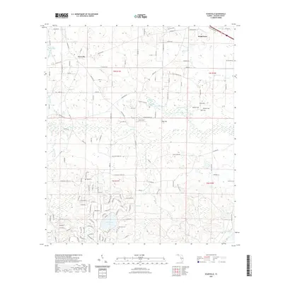
2021 Map of Kynesville
USGS Topo · Published 2021About this map
The settlement of Kynesville and the southern outskirts of Marianna anchor this Jackson County landscape, characterized by a complex network of springs, sinks, and ponds. The terrain is notably pocketed with karst features like Blue Sink, Bonnet Sink, and Mule Sink, alongside numerous spring-fed waters such as Gadsen Spring and Springboard Spring. These water sources historically dictated the location of homesteads and small-scale agriculture throughout the region.
Find a feature on this map
153 named features on this map. Tap any name to fly to it.
Don’t see what you’re looking for? This feature index may not catch every label — zoom into the map to look around manually.
Map Details
Editions of this 2021 Kynesville Map
This is the sole edition of this map. No revisions or reprints were ever made.
Other maps of this area

1952 · Oakdale
USGS Topo · 1:24,000

1952 · Kynesville
USGS Topo · 1:24,000

1952 · Alford SE
USGS Topo · 1:24,000

1952 · Altha West
USGS Topo · 1:24,000

1952 · Cottondale East
USGS Topo · 1:24,000

1952 · Cottondale West
USGS Topo · 1:24,000
1952 · Compass Lake
USGS Topo · 1:24,000
1952 · Alford
USGS Topo · 1:24,000

1952 · Marianna
USGS Topo · 1:24,000

1954 · Tallahassee
USGS Topo · 1:250,000