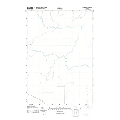
2011 Map of La Branche
USGS Topo · Published 2011About this map
Ford River dominates this portion of the Upper Peninsula, carving a winding path through the northern landscape of Menominee County. The waterway is joined by the West Branch Ford River as it moves eastward, creating a complex drainage network typical of the region's timber and water-rich geography. Near the southern edge of the survey sits the settlement of LaBranche, a small community situated along a north-south road corridor. The map highlights the sparse, rural nature of this area in the early 21st century, focusing on the essential relationship between the few established roads and the prominent river systems that define the terrain.
Find a feature on this map
3 named features on this map. Tap any name to fly to it.
Don’t see what you’re looking for? This feature index may not catch every label — zoom into the map to look around manually.
Map Details
Editions of this 2011 La Branche Map
This is the sole edition of this map. No revisions or reprints were ever made.
Other maps of this area

1932 · Whitney NE
USGS Topo · 1:31,680

1932 · Whitney SE
USGS Topo · 1:31,680

1932 · Helena SW
USGS Topo · 1:31,680

1932 · Helena
USGS Topo · 1:31,680

1951 · Helena SW
USGS Topo · 1:31,680

1951 · Helena
USGS Topo · 1:31,680

1954 · Escanaba
USGS Topo · 1:250,000

1956 · Foster City
USGS Topo · 1:62,500

1957 · Escanaba
USGS Topo · 1:250,000

1957 · Northland
USGS Topo · 1:62,500