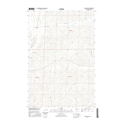
2017 Map of La Crosse East
USGS Topo · Published 2017About this map
Lacrosse sits at the western edge of this agricultural landscape in Whitman County, where the Palouse hills are deeply incised by the drainages of Union Flat Creek and Willow Creek. The topography is defined by high, winding ridges and draws, revealing a complex network of rural access roads that follow the natural contours of the land. Key transit corridors like Hay-Lacrosse Rd and Winona S Rd connect the town to outlying farmsteads and specialized locations such as Lester Camp Rd and Cemetary Rd. The map illustrates a drainage pattern focused on the southern flow of Mud Flat Creek, reflecting the importance of water management in this dryland wheat region. This 2017 survey details the enduring cadastral boundaries of Townships 15 and 16 North, marking the persistence of early land divisions in modern Washington.
Find a feature on this map
24 named features on this map. Tap any name to fly to it.
Don’t see what you’re looking for? This feature index may not catch every label — zoom into the map to look around manually.
Map Details
Editions of this 2017 La Crosse East Map
This is the sole edition of this map. No revisions or reprints were ever made.
Other maps of this area

1950 · La Crosse
USGS Topo · 1:62,500

1950 · Penawawa
USGS Topo · 1:62,500

1950 · Endicott
USGS Topo · 1:62,500

1950 · Hay
USGS Topo · 1:62,500

1952 · Hay
USGS Topo · 1:62,500

1952 · La Crosse
USGS Topo · 1:62,500

1955 · Pullman
USGS Topo · 1:250,000

1958 · Pullman
USGS Topo · 1:250,000

1981 · Dusty
USGS Topo · 1:24,000
1981 · La Crosse West
USGS Topo · 1:24,000