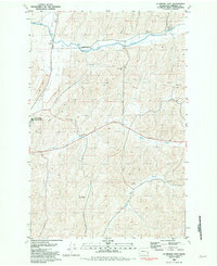
1981 Map of La Crosse East
USGS Topo · Published 1981About this map
La Crosse serves as the focal point of this eastern Washington landscape, where the Union Pacific railroad cuts across the northern terrain. The region's agricultural character is clearly defined by several Grain Elevators and clusters of Storage Bins that dot the countryside, indicating a productive grain-growing economy in the early 1980s. Waterways like Union Flat Creek, Willow Creek, and Mud Flat Creek meander through the hills, providing natural drainage for the surrounding farmland. Small named locales such as Wasselman and Wies appear alongside evidence of local infrastructure, including a Landing Strip and industrial features like a Gravel Pit and Borrow Pit. The map captures a specific moment in the rural development of Whitman County, preserving the placement of rural homesteads and transport links that supported the community's primary industries.
Find a feature on this map
14 named features on this map. Tap any name to fly to it.
Don’t see what you’re looking for? This feature index may not catch every label — zoom into the map to look around manually.
Map Details
Editions of this 1981 La Crosse East Map
This is the sole edition of this map. No revisions or reprints were ever made.
Other maps of this area

1950 · La Crosse
USGS Topo · 1:62,500

1950 · Penawawa
USGS Topo · 1:62,500

1950 · Endicott
USGS Topo · 1:62,500

1950 · Hay
USGS Topo · 1:62,500

1952 · Hay
USGS Topo · 1:62,500

1952 · La Crosse
USGS Topo · 1:62,500

1955 · Pullman
USGS Topo · 1:250,000

1958 · Pullman
USGS Topo · 1:250,000

1981 · Dusty
USGS Topo · 1:24,000
1981 · La Crosse West
USGS Topo · 1:24,000