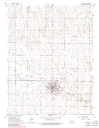
1966 Map of La Crosse
USGS Topo · Published 1983About this map
La Crosse serves as the central hub of this mid-century Kansas landscape, situated at the intersection of the Missouri Pacific railroad and regional roads. The town's social and municipal structure is well-defined, featuring the County Fairground, Grass Park, and a Drive-in Theater south of the main residential grid. For genealogists, the map identifies three distinct burial grounds: Friends Cem to the northwest, and St Michaels Cem and La Crosse Cem on the eastern outskirts.
Find a feature on this map
21 named features on this map. Tap any name to fly to it.
Don’t see what you’re looking for? This feature index may not catch every label — zoom into the map to look around manually.
Map Details
Editions of this 1966 La Crosse Map
2 editions found
Other maps of this area

1889 · Larned
USGS Topo · 1:125,000

1891 · Larned
USGS Topo · 1:125,000

1896 · Hays
USGS Topo · 1:125,000

1955 · Great Bend
USGS Topo · 1:250,000

1957 · Great Bend
USGS Topo · 1:250,000

1958 · Great Bend
USGS Topo · 1:250,000

1966 · Rush Center
USGS Topo · 1:24,000

1966 · Nekoma
USGS Topo · 1:24,000

1966 · La Crosse
USGS Topo · 1:24,000

1966 · Hargrave
USGS Topo · 1:24,000