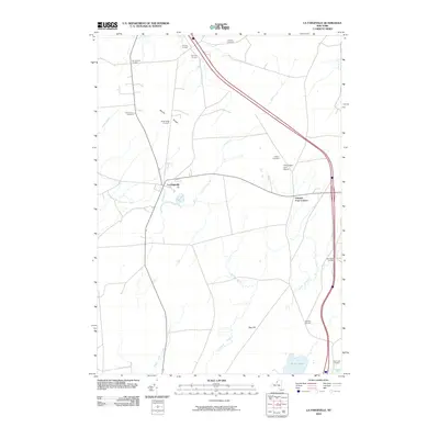
2010 Map of La Fargeville
USGS Topo · Published 2010About this map
La Fargeville serves as the central hub of this Jefferson County landscape, where the Chaumont River and Stone Mills Creek converge. The settlement pattern is defined by several distinct crossroads, including De La Farge Corners, Strough Corners, and Tanners Corners, which reflect the area's agricultural heritage and local family legacies. The terrain rises toward Beech Ridge and Dog Hill, providing a backdrop for the numerous small cemeteries that dot the countryside, such as Hinman Cemetery and Orleans Cemetery. The eastern edge of the map is dominated by a modern transportation corridor that bypasses Orleans Four Corners, while Perch Lake anchors the southern boundary. This 2010 survey documents the enduring rural character of the region, from the Tims Angus Farm Airport to the various creeks like Hyde Creek and Carter Creek that drain the farmland.
Find a feature on this map
23 named features on this map. Tap any name to fly to it.
Don’t see what you’re looking for? This feature index may not catch every label — zoom into the map to look around manually.
Map Details
Editions of this 2010 La Fargeville Map
This is the sole edition of this map. No revisions or reprints were ever made.
Other maps of this area

1900 · Clayton
USGS Topo · 1:62,500

1903 · Grindstone
USGS Topo · 1:62,500

1903 · Clayton
USGS Topo · 1:62,500

1903 · Alexandria Bay
USGS Topo · 1:62,500

1903 · Theresa
USGS Topo · 1:62,500

1942 · Clayton
USGS Topo · 1:24,000
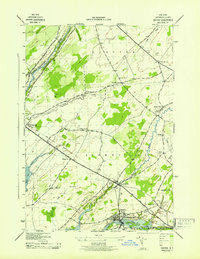
1943 · Dexter
USGS Topo · 1:31,680

1943 · Thousand Island Park
USGS Topo · 1:31,680

1943 · Redwood
USGS Topo · 1:31,680

1943 · Clayton
USGS Topo · 1:31,680