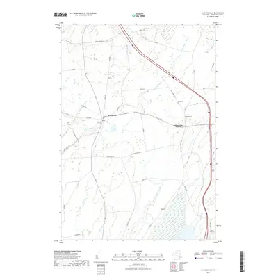
2019 Map of La Fargeville
USGS Topo · Published 2019About this map
La Fargeville sits at the heart of this Jefferson County landscape, where the Chaumont River winds through a patchwork of agricultural flats and wooded rises. The settlement pattern is defined by historic corridors like Plank Rd and the Rivergate Trail, which connects the main village to Orleans Four Corners to the east. The area is notable for its numerous small family and community burial grounds, including Saint Johns Cem, Beech Ridge Cem, and the Hinman Cem, which offer significant genealogical value for researchers of the region's early families.
Find a feature on this map
53 named features on this map. Tap any name to fly to it.
Don’t see what you’re looking for? This feature index may not catch every label — zoom into the map to look around manually.
Map Details
Editions of this 2019 La Fargeville Map
This is the sole edition of this map. No revisions or reprints were ever made.
Other maps of this area

1900 · Clayton
USGS Topo · 1:62,500

1903 · Grindstone
USGS Topo · 1:62,500

1903 · Clayton
USGS Topo · 1:62,500

1903 · Alexandria Bay
USGS Topo · 1:62,500

1903 · Theresa
USGS Topo · 1:62,500

1942 · Clayton
USGS Topo · 1:24,000
1943 · Dexter
USGS Topo · 1:31,680

1943 · Thousand Island Park
USGS Topo · 1:31,680

1943 · Redwood
USGS Topo · 1:31,680

1943 · Clayton
USGS Topo · 1:31,680