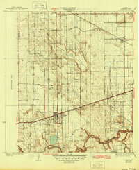
1936 Map of La Feria
USGS Topo · Published 1945About this map
The agricultural landscape of the Lower Rio Grande Valley is captured here during the mid-1930s, centered on the growing town of La Feria. The map reveals a complex grid of irrigation-era roads such as City Road and Parker Road, which supported the citrus and vegetable farming economy of Cameron County. Transportation is dominated by the parallel tracks of the Southern Pacific and Missouri Pacific railroads, which facilitated the movement of goods from settlements like Santa Rosa and Primera. Natural drainage and water management are prominent, characterized by the winding Arroyo Colorado at the southern edge and the expansive Tiocano Lake Bed. Smaller rural nodes like Smart Place and Chasladd appear alongside local landmarks like the Wilson Sch, providing a detailed view of the region's development before post-war urbanization.
Find a feature on this map
27 named features on this map. Tap any name to fly to it.
Don’t see what you’re looking for? This feature index may not catch every label — zoom into the map to look around manually.
Map Details
Editions of this 1936 La Feria Map
3 editions found
Other maps of this area

1929 · Harlingen
USGS Topo · 1:24,000

1929 · Santa Rosa
USGS Topo · 1:24,000

1929 · Santa Maria
USGS Topo · 1:24,000

1929 · La Feria
USGS Topo · 1:24,000

1929 · La Paloma
USGS Topo · 1:24,000

1932 · Combes
USGS Topo · 1:31,680

1932 · Harlingen
USGS Topo · 1:31,680

1933 · Santa Rosa
USGS Topo · 1:31,680

1936 · La Feria
USGS Topo · 1:31,680

1936 · Santa Maria
USGS Topo · 1:31,680