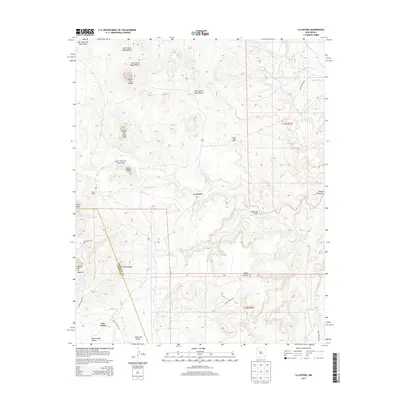
2013 Map of La Gotera
USGS Topo · Published 2013About this map
Evans Ranch and Rancho Agua Blanca sit amidst the complex topography of Sandoval and Cibola Counties, where the high desert is carved by seasonal watercourses like Salado Cr and Cañon del Piojo. The 2013 landscape is defined by its massive geographic features, including Mesita de la Madera and Mesa Cocina, which dominate the southern reaches near the San Antonio Valley. This region is also shaped by tribal land management, with a portion of the Laguna Indian Res clearly delineated in the northeast.
Find a feature on this map
26 named features on this map. Tap any name to fly to it.
Don’t see what you’re looking for? This feature index may not catch every label — zoom into the map to look around manually.
Map Details
Editions of this 2013 La Gotera Map
This is the sole edition of this map. No revisions or reprints were ever made.
Other maps of this area

1883 · Mt. Taylor
USGS Topo · 1:250,000

1886 · Mt. Taylor
USGS Topo · 1:250,000

1892 · Mt. Taylor
USGS Topo · 1:250,000

1899 · Mt. Taylor
USGS Topo · 1:250,000

1954 · Herrera
USGS Topo · 1:24,000

1957 · Moquino
USGS Topo · 1:24,000
1957 · Arch Mesa
USGS Topo · 1:24,000

1958 · Albuquerque
USGS Topo · 1:250,000

1961 · Marquez
USGS Topo · 1:24,000

1961 · Cerro Tinaja
USGS Topo · 1:24,000