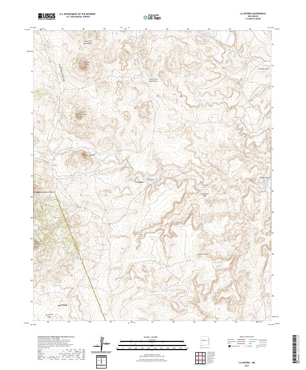
2023 Map of La Gotera
USGS Topo · Published 2023About this map
La Gotera and the surrounding high desert terrain define this corner of the New Mexico landscape where the Sandoval County and Cibola County line intersects. The geography is characterized by dramatic elevations, including the prominent Cerro de Santa Rosa and Cerro Chato, which overlook a network of seasonal drainage paths like Salado Creek and Cañada Salada. Evidence of water sources in this arid environment is noted at Ojo De Santa Rosa and Pino Spring, which have historically dictated the placement of small outposts and ranching corridors.
Find a feature on this map
22 named features on this map. Tap any name to fly to it.
Don’t see what you’re looking for? This feature index may not catch every label — zoom into the map to look around manually.
Map Details
Editions of this 2023 La Gotera Map
This is the sole edition of this map. No revisions or reprints were ever made.
Other maps of this area

1883 · Mt. Taylor
USGS Topo · 1:250,000

1886 · Mt. Taylor
USGS Topo · 1:250,000

1892 · Mt. Taylor
USGS Topo · 1:250,000

1899 · Mt. Taylor
USGS Topo · 1:250,000

1954 · Herrera
USGS Topo · 1:24,000

1957 · Moquino
USGS Topo · 1:24,000
1957 · Arch Mesa
USGS Topo · 1:24,000

1958 · Albuquerque
USGS Topo · 1:250,000

1961 · Marquez
USGS Topo · 1:24,000

1961 · Cerro Tinaja
USGS Topo · 1:24,000