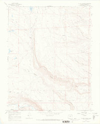
1967 Map of La Jara Canyon
USGS Topo · Published 1969About this map
Braiden Cow Camp and the small settlement of Darley stand as human outposts in this high-altitude landscape of the Rio Grande National Forest. The topography is defined by the deep incisions of La Jara Canyon and the Conejos River valley, where a complex network of ranching infrastructure is visible. A Stock Driveway and various pack trails wind through Big Meadows and along Bald Ridge, illustrating the seasonal movement of livestock through these subalpine basins. The area is water-rich, featuring numerous high-country basins such as Chicago Bogs, La Jara Res, and Bluebird Reservoir. These features, combined with the detailed record of canyons like Romero Canyon and Leandro Canyon, reflect a landscape managed for both timber and grazing during the late 1960s.
Find a feature on this map
28 named features on this map. Tap any name to fly to it.
Don’t see what you’re looking for? This feature index may not catch every label — zoom into the map to look around manually.
Map Details
Editions of this 1967 La Jara Canyon Map
4 editions found
Other maps of this area

1922 · Conejos
USGS Topo · 1:125,000

1945 · Durango
USGS Topo · 1:250,000

1953 · Durango
USGS Topo · 1:250,000

1954 · Durango
USGS Topo · 1:250,000

1961 · Durango
USGS Topo · 1:250,000

1963 · Durango
USGS Topo · 1:250,000

1966 · Durango
USGS Topo · 1:250,000
1967 · Osier
USGS Topo · 1:24,000
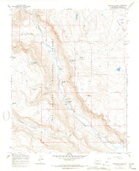
1967 · Spectacle Lake
USGS Topo · 1:24,000
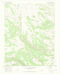
1967 · La Jara Canyon
USGS Topo · 1:24,000