
1965 Map of La Junta SW
USGS Topo · Published 1969About this map
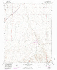
The Atchison Topeka and Santa Fe railroad cuts a straight diagonal through this high plains landscape southwest of La Junta. This transit corridor follows a historic path near a noted Historical Monument and an old Trail, marking the intersection of indigenous routes, pioneer travel, and industrial expansion. The terrain is defined by a series of north-flowing drainages including Timpas Creek, Crooked Arroyo, and Benton Arroyo, which create a complex system of ridges and depressions. This 1965 field survey captures the rural infrastructure of Otero County, showing a network of unimproved roads and a Pipeline traversing the land alongside small industrial markers like a Drill Hole. The convergence of the West Branch and East Branch further south illustrates the hydrological patterns that dictated early land use in this arid region.
Find a feature on this map
10 named features on this map. Tap any name to fly to it.
Don’t see what you’re looking for? This feature index may not catch every label — zoom into the map to look around manually.
Map Details
Editions of this 1965 La Junta SW Map
2 editions found
Other maps of this area

1891 · Timpas
USGS Topo · 1:125,000

1894 · Timpas
USGS Topo · 1:125,000

1955 · La Junta
USGS Topo · 1:250,000

1958 · La Junta
USGS Topo · 1:250,000

1966 · La Junta SE
USGS Topo · 1:24,000
1966 · Hawley
USGS Topo · 1:24,000
1966 · La Junta
USGS Topo · 1:24,000

1968 · La Junta
USGS Topo · 1:250,000
1972 · Timpas NE
USGS Topo · 1:24,000

1972 · Packers Gap
USGS Topo · 1:24,000