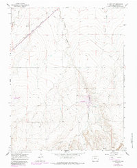
1965 Map of La Junta SW
USGS Topo · Published 1985About this map
The Atchison Topeka and Santa Fe railroad cuts a straight diagonal across this high plains landscape, following the path of the old Santa Fe Trail. Just north of the tracks, a Historical Monument marks this important transit corridor through Otero County. The terrain is defined by a series of drainage systems, including Timpas Creek, Crooked Arroyo, and Benton Arroyo, which flow toward the Arkansas River valley to the northeast.
Find a feature on this map
13 named features on this map. Tap any name to fly to it.
Don’t see what you’re looking for? This feature index may not catch every label — zoom into the map to look around manually.
Map Details
Editions of this 1965 La Junta SW Map
2 editions found
Other maps of this area

1891 · Timpas
USGS Topo · 1:125,000

1894 · Timpas
USGS Topo · 1:125,000

1955 · La Junta
USGS Topo · 1:250,000

1958 · La Junta
USGS Topo · 1:250,000

1965 · La Junta SW
USGS Topo · 1:24,000

1966 · La Junta SE
USGS Topo · 1:24,000
1966 · Hawley
USGS Topo · 1:24,000
1966 · La Junta
USGS Topo · 1:24,000

1968 · La Junta
USGS Topo · 1:250,000
1972 · Timpas NE
USGS Topo · 1:24,000