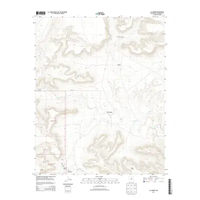
2013 Map of La Liendre
USGS Topo · Published 2013About this map
The Gallinas River meanders through this portion of San Miguel County, carving a path through high-elevation terrain where small settlements and ranching outposts are scattered among deep canyons. The village of La Liendre serves as a central point in a landscape defined by dramatic geological features, including Cañon del Agua and the prominent Mesas Cuatas. To the southwest, the community of Aguilar is noted alongside the Aguilar Cem, providing a focal point for genealogical interest in this rural New Mexico corridor.
Find a feature on this map
16 named features on this map. Tap any name to fly to it.
Don’t see what you’re looking for? This feature index may not catch every label — zoom into the map to look around manually.
Map Details
Editions of this 2013 La Liendre Map
This is the sole edition of this map. No revisions or reprints were ever made.
Other maps of this area

1889 · Las Vegas
USGS Topo · 1:125,000

1890 · Bernal
USGS Topo · 1:125,000

1891 · Bernal
USGS Topo · 1:125,000

1891 · Las Vegas
USGS Topo · 1:125,000

1892 · Watrous
USGS Topo · 1:125,000

1892 · Corazon
USGS Topo · 1:125,000

1893 · Las Vegas
USGS Topo · 1:125,000

1894 · Corazon
USGS Topo · 1:125,000

1894 · Watrous
USGS Topo · 1:125,000

1894 · Bernal
USGS Topo · 1:125,000