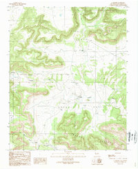
1989 Map of La Liendre
USGS Topo · Published 1989About this map
Gallinas River winds through this high desert landscape, serving as a vital corridor for settlement in San Miguel County. The village of La Liendre stands near a traditional river crossing, while further west, Concepcion and Aguilar appear as quiet outposts of the rural New Mexico ranching tradition. The topography is defined by massive landforms such as the Las Vegas Mesa and Mesa de los Carros, which tower over the deep drainages of Cañon del Agua and Cañon de las Mujeres Creek. This survey provides a look at the scattered infrastructure of the late 1980s, documenting a remote network of windmills and small family plots, including a Cem near Aguilar, that suggest long-standing generational ties to the land before the modernization of the ranching frontier.
Find a feature on this map
18 named features on this map. Tap any name to fly to it.
Don’t see what you’re looking for? This feature index may not catch every label — zoom into the map to look around manually.
Map Details
Editions of this 1989 La Liendre Map
This is the sole edition of this map. No revisions or reprints were ever made.
Other maps of this area

1889 · Las Vegas
USGS Topo · 1:125,000

1890 · Bernal
USGS Topo · 1:125,000

1891 · Bernal
USGS Topo · 1:125,000

1891 · Las Vegas
USGS Topo · 1:125,000

1892 · Watrous
USGS Topo · 1:125,000

1892 · Corazon
USGS Topo · 1:125,000

1893 · Las Vegas
USGS Topo · 1:125,000

1894 · Corazon
USGS Topo · 1:125,000

1894 · Watrous
USGS Topo · 1:125,000

1894 · Bernal
USGS Topo · 1:125,000