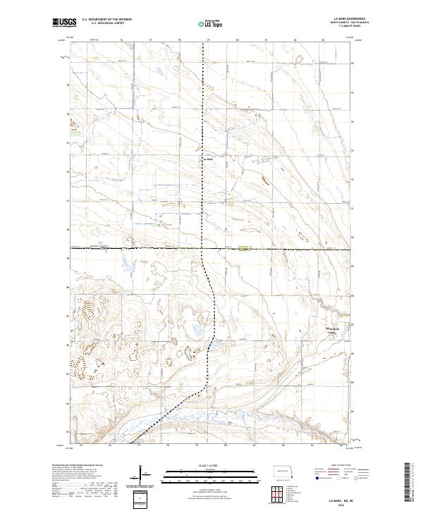
2024 Map of La Mars
USGS Topo · Published 2024About this map
Richland County in North Dakota and Roberts County in South Dakota meet along the prominent boundary line that bisects this landscape. The settlement of La Mars serves as a focal point in the northern portion of the map, situated among a strictly organized grid of agricultural roads such as Co Rd 81 and Co Rd 22. To the southeast, the White Rock Colony is a notable landmark near the state line, illustrating the specialized community structures found in this prairie region. The terrain is characterized by a high density of wetlands and small water bodies that break the regularity of the section lines, reflecting the natural drainage patterns of the Red River Valley hinterlands. Researchers can trace the intersections of early 20th-century township boundaries like t129n r48w and t128n r48w against modern thoroughfares.
Find a feature on this map
30 named features on this map. Tap any name to fly to it.
Don’t see what you’re looking for? This feature index may not catch every label — zoom into the map to look around manually.
Map Details
Editions of this 2024 La Mars Map
This is the sole edition of this map. No revisions or reprints were ever made.
Other maps of this area

1904 · Wahpeton
USGS Topo · 1:125,000

1915 · White Rock
USGS Topo · 1:62,500

1917 · New Effington
USGS Topo · 1:62,500

1918 · White Rock
USGS Topo · 1:62,500

1953 · Milbank
USGS Topo · 1:250,000

1953 · Fargo
USGS Topo · 1:250,000

1956 · Fargo
USGS Topo · 1:250,000

1958 · Milbank
USGS Topo · 1:250,000

1964 · Hankinson SE
USGS Topo · 1:24,000
1972 · La Mars
USGS Topo · 1:24,000
Featured Places
- Fairmount Township, ND
- Lake Traverse District, SD
- LaMars Township, ND
- White Rock Hutterite Colony, SD
- La Mars, ND