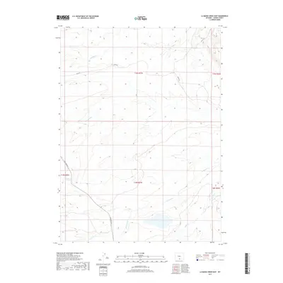
2017 Map of La Marsh Creek East
USGS Topo · Published 2017About this map
Hugus Cliff overlooks an arid, drainage-cut landscape in Carbon County, where the high desert terrain is defined by seasonal waterways and ranching infrastructure. This area of Wyoming shows a sparse but organized network of roads, notably Bolten Rd and Sage Creek Rd, which navigate the various creek basins. The hydrology is dominated by several converging drainages, including Rasmussen Cr, La Marsh Cr, and Little Sage Cr, reflecting the region's reliance on these water courses for land use. Significant for local history and water rights research, the presence of Deadman Springs and Lone Tree Cr highlights specific points of interest in an otherwise wide-open rangeland. The map provides a precise look at these natural landmarks and the grid system that governs this part of the American West.
Find a feature on this map
15 named features on this map. Tap any name to fly to it.
Don’t see what you’re looking for? This feature index may not catch every label — zoom into the map to look around manually.
Map Details
Editions of this 2017 La Marsh Creek East Map
This is the sole edition of this map. No revisions or reprints were ever made.
Other maps of this area

1932 · Savery
USGS Topo · 1:96,000

1940 · Savery
USGS Topo · 1:125,000

1954 · Rawlins
USGS Topo · 1:250,000

1956 · Bridger Pass
USGS Topo · 1:62,500

1956 · Bolten Ranch
USGS Topo · 1:62,500

1958 · Rawlins
USGS Topo · 1:250,000

1961 · Middlewood Hill
USGS Topo · 1:24,000

1961 · Pine Grove Ranch
USGS Topo · 1:24,000

1961 · Jack Creek Reservoir
USGS Topo · 1:24,000

1962 · Rawlins
USGS Topo · 1:250,000