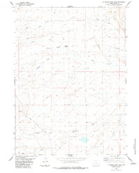
1983 Map of La Marsh Creek East
USGS Topo · Published 1983About this map
The historical Overland Trail cuts across this high-plains landscape, marking a vital transit corridor through Carbon County. This 1983 survey preserves the location of the Sage Creek Stage Station (Site), a crucial stop for travelers and mail long before the development of modern highways. The drainage network is defined by numerous seasonal and perennial watercourses, including Little Sage Creek, Miller Creek, and Deadman Creek, which dictate the movement of both historic trails and later routes like Bolten Road.
Find a feature on this map
15 named features on this map. Tap any name to fly to it.
Don’t see what you’re looking for? This feature index may not catch every label — zoom into the map to look around manually.
Map Details
Editions of this 1983 La Marsh Creek East Map
This is the sole edition of this map. No revisions or reprints were ever made.
Other maps of this area

1932 · Savery
USGS Topo · 1:96,000

1940 · Savery
USGS Topo · 1:125,000

1954 · Rawlins
USGS Topo · 1:250,000

1956 · Bridger Pass
USGS Topo · 1:62,500

1956 · Bolten Ranch
USGS Topo · 1:62,500

1958 · Rawlins
USGS Topo · 1:250,000

1961 · Middlewood Hill
USGS Topo · 1:24,000

1961 · Pine Grove Ranch
USGS Topo · 1:24,000

1961 · Jack Creek Reservoir
USGS Topo · 1:24,000

1962 · Rawlins
USGS Topo · 1:250,000