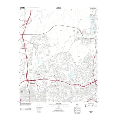
2012 Map of La Mesa
USGS Topo · Published 2012About this map
The San Diego River carves through this urban and canyon-riven landscape, providing a natural corridor between the high peaks of Fortuna Mountain and Cowles Mountain. To the south, the academic hub around San Diego State University in College Heights anchors a dense residential network that includes neighborhoods like Allied Gardens and Del Cerro. The area's critical infrastructure is evident in the path of the Second San Diego Aqueduct and the presence of the Murray Reservoir. In the northeast corner, the Santee Recreational Lakes offer a contrast to the industrial and logistical focus of the nearby Sycamore Sanitary Landfill. This 2012 survey illustrates the complex geography where steep-sided terrain like Murphy Canyon and Oak Canyon meets the expansive development of San Diego and La Mesa.
Find a feature on this map
49 named features on this map. Tap any name to fly to it.
Don’t see what you’re looking for? This feature index may not catch every label — zoom into the map to look around manually.
Map Details
Editions of this 2012 La Mesa Map
This is the sole edition of this map. No revisions or reprints were ever made.
Other maps of this area

1893 · El Cajon
USGS Topo · 1:62,500

1901 · Elcajon
USGS Topo · 1:62,500

1903 · Cuyamaca
USGS Topo · 1:125,000

1903 · La Jolla
USGS Topo · 1:62,500

1903 · Elcajon
USGS Topo · 1:62,500

1904 · San Diego
USGS Topo · 1:62,500

1904 · Southern California Sheet No. 2
USGS Topo · 1:250,000

1930 · La Jolla
USGS Topo · 1:62,500

1930 · San Diego
USGS Topo · 1:62,500

1939 · El Cajon
USGS Topo · 1:62,500