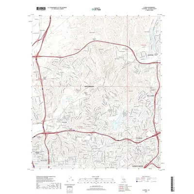
2018 Map of La Mesa
USGS Topo · Published 2018About this map
The San Diego River winds through this heavily developed region of San Diego County, marking a stark contrast between the urban sprawl and the preserved peaks of the Mission Trails area. The steep slopes of Cowles Mtn and Fortuna Mtn rise above the suburban neighborhoods of La Mesa, El Cajon, and Lemon Grove. This 2018 survey documents a landscape defined by critical infrastructure, showing the Second San Diego Aqueduct and the Murray Reservoir providing essential water resources to the expanding metropolitan area.
Find a feature on this map
272 named features on this map. Tap any name to fly to it.
Don’t see what you’re looking for? This feature index may not catch every label — zoom into the map to look around manually.
Map Details
Editions of this 2018 La Mesa Map
This is the sole edition of this map. No revisions or reprints were ever made.
Other maps of this area

1893 · El Cajon
USGS Topo · 1:62,500

1901 · Elcajon
USGS Topo · 1:62,500

1903 · Cuyamaca
USGS Topo · 1:125,000

1903 · La Jolla
USGS Topo · 1:62,500

1903 · Elcajon
USGS Topo · 1:62,500

1904 · San Diego
USGS Topo · 1:62,500

1904 · Southern California Sheet No. 2
USGS Topo · 1:250,000

1930 · La Jolla
USGS Topo · 1:62,500

1930 · San Diego
USGS Topo · 1:62,500

1939 · El Cajon
USGS Topo · 1:62,500