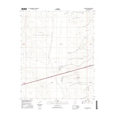
2017 Map of La Mesita Negra
USGS Topo · Published 2017About this map
The Rio Puerco meanders through the heart of this high desert terrain west of Albuquerque, defining the drainage patterns of the western mesas. This landscape is punctuated by the prominent basaltic landform of La Mesita Negra and the neighboring Cerro Colorado, which rise above the surrounding alluvial plains. Historically part of the expansion of infrastructure across the Southwest, the map illustrates the modern path of Central Ave NW as it bisects the quadrangle, following the general corridor of historic transportation routes. Branching off this main artery are localized networks such as Speedway Park Blvd Nw and several utility corridors, including the Gas Pipeline Track. Along the edges of the valley, seasonal drainages like Cañada del Ojo and Cañada los Apaches carve into the tablelands, revealing the intricate natural topography that has influenced ranching and transit in Bernalillo County for generations.
Find a feature on this map
19 named features on this map. Tap any name to fly to it.
Don’t see what you’re looking for? This feature index may not catch every label — zoom into the map to look around manually.
Map Details
Editions of this 2017 La Mesita Negra Map
This is the sole edition of this map. No revisions or reprints were ever made.
Other maps of this area

1883 · Mt. Taylor
USGS Topo · 1:250,000

1886 · Mt. Taylor
USGS Topo · 1:250,000

1888 · Bernalillo
USGS Topo · 1:125,000

1889 · Albuquerque
USGS Topo · 1:125,000

1892 · Mt. Taylor
USGS Topo · 1:250,000

1893 · Albuquerque
USGS Topo · 1:125,000

1899 · Mt. Taylor
USGS Topo · 1:250,000

1917 · Cerro Verde
USGS Topo · 1:125,000

1952 · Wind Mesa
USGS Topo · 1:24,000

1952 · Dalies NW
USGS Topo · 1:24,000