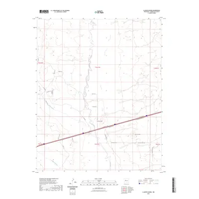
2023 Map of La Mesita Negra
USGS Topo · Published 2023About this map
The Rio Puerco carves a winding path through this arid landscape west of Albuquerque, defining the drainage patterns and historical movement across the high desert. Near the center of the sheet, the settlement of La Mesita Negra sits as a lonely waypoint amidst a network of modern transit and utility corridors. To the south, the prominent rise of Cerro Colorado anchors the terrain, while the deep cuts of Cañada del Oro and Cañada los Apaches channel seasonal runoff from the surrounding mesas. The infrastructure of the modern era is etched into the earth here, ranging from the broad sweep of Central Ave NW to industrial markers like the Gas Pipeline Track. This area represents the convergence of older ranching and tribal routes, such as Tribal Rd N57, with the expanding reach of the city's western edge, evidenced by the developing street names like Speedway Park Blvd NW.
Find a feature on this map
30 named features on this map. Tap any name to fly to it.
Don’t see what you’re looking for? This feature index may not catch every label — zoom into the map to look around manually.
Map Details
Editions of this 2023 La Mesita Negra Map
This is the sole edition of this map. No revisions or reprints were ever made.
Other maps of this area

1883 · Mt. Taylor
USGS Topo · 1:250,000

1886 · Mt. Taylor
USGS Topo · 1:250,000

1888 · Bernalillo
USGS Topo · 1:125,000

1889 · Albuquerque
USGS Topo · 1:125,000

1892 · Mt. Taylor
USGS Topo · 1:250,000

1893 · Albuquerque
USGS Topo · 1:125,000

1899 · Mt. Taylor
USGS Topo · 1:250,000

1917 · Cerro Verde
USGS Topo · 1:125,000

1952 · Wind Mesa
USGS Topo · 1:24,000

1952 · Dalies NW
USGS Topo · 1:24,000