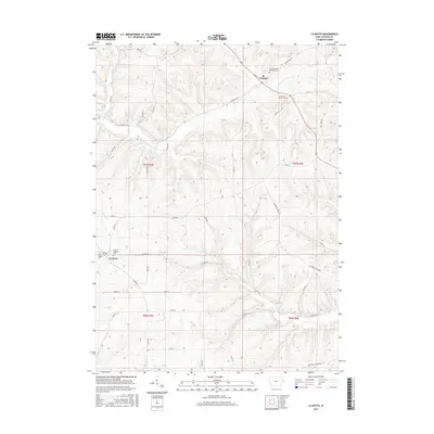
2015 Map of La Motte
USGS Topo · Published 2015About this map
St. Donatus and La Motte anchor this survey of eastern Iowa, a region defined by its winding creek valleys and long-standing religious heritage. The landscape is carved by a dense network of waterways, including Tete des Morts Cr, Mill Cr, and Spruce Cr, which have dictated the placement of rural roads like Centerville Rd and Bellevue Cascade Rd. Genealogists will find significant value in the documentation of local burial grounds, ranging from the prominent Saint Donatus Catholic Cem and Holy Rosary Cem to the smaller, more secluded Federman Farm Cem. This 2015 update provides a modern look at these traditional settlements, showing how contemporary infrastructure like Co Hwy D57 integrates with the established section lines and natural drainages of Jackson County.
Find a feature on this map
32 named features on this map. Tap any name to fly to it.
Don’t see what you’re looking for? This feature index may not catch every label — zoom into the map to look around manually.
Map Details
Editions of this 2015 La Motte Map
This is the sole edition of this map. No revisions or reprints were ever made.
Other maps of this area

1891 · Maquoketa
USGS Topo · 1:62,500

1901 · Peosta
USGS Topo · 1:125,000

1911 · Galena
USGS Topo · 1:62,500

1913 · Galena
USGS Topo · 1:62,500

1935 · East Dubuque
USGS Topo · 1:62,500

1935 · Miles
USGS Topo · 1:62,500

1940 · East Dubuque
USGS Topo · 1:62,500

1941 · Miles
USGS Topo · 1:62,500

1955 · Menominee
USGS Topo · 1:24,000

1955 · Dubuque South
USGS Topo · 1:24,000