
1913 Map of Galena
USGS Topo · Published 1913About this map
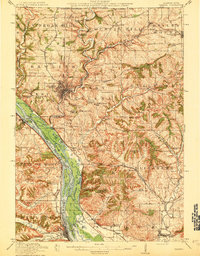
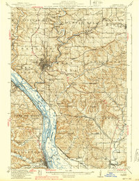
Galena serves as the focal point of this 1913 survey, situated along the Galena River amidst a landscape shaped by active mining and river commerce. The terrain north and east of the city is dotted with numerous lead and zinc operations, including the Unity Mine, Tenstrike Mine, and Blackjack Mine. This industrial activity is supported by a dense network of railroads like the Illinois Central and the Chicago Burlington and Quincy, which follow the river valleys and bluffs.
Find a feature on this map
90 named features on this map. Tap any name to fly to it.
Don’t see what you’re looking for? This feature index may not catch every label — zoom into the map to look around manually.
Map Details
Editions of this 1913 Galena Map
3 editions found
Other maps of this area

1891 · Maquoketa
USGS Topo · 1:62,500

1892 · Savanna
USGS Topo · 1:62,500

1900 · Lancaster
USGS Topo · 1:125,000

1901 · Peosta
USGS Topo · 1:125,000

1902 · Mineral Point
USGS Topo · 1:125,000

1904 · Lancaster
USGS Topo · 1:125,000

1908 · Lancaster
USGS Topo · 1:125,000

1911 · Elizabeth
USGS Topo · 1:62,500

1911 · Galena
USGS Topo · 1:62,500

1935 · East Dubuque
USGS Topo · 1:62,500