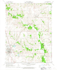
1966 Map of La Plata
USGS Topo · Published 1967About this map
La Plata serves as a significant rail junction in northern Missouri during the mid-1960s, where the Atchison Topeka and Santa Fe intersects with the Norfolk and Western line. This intersection defined the local economy and settlement pattern, providing a hub for the surrounding agricultural townships of Wilson, La Plata, and Johnston. The landscape is characterized by the dissected uplands of the Middle Fork Salt River and its tributaries, including Bear Creek and Titus Creek.
Find a feature on this map
21 named features on this map. Tap any name to fly to it.
Don’t see what you’re looking for? This feature index may not catch every label — zoom into the map to look around manually.
Map Details
Editions of this 1966 La Plata Map
This is the sole edition of this map. No revisions or reprints were ever made.
Other maps of this area

1903 · Edina
USGS Topo · 1:125,000

1908 · Atlanta
USGS Topo · 1:62,500

1937 · Elmer
USGS Topo · 1:48,000

1938 · Kirksville
USGS Topo · 1:62,500

1940 · Kirksville
USGS Topo · 1:62,500

1942 · Elmer
USGS Topo · 1:62,500

1953 · Moberly
USGS Topo · 1:250,000

1954 · Centerville
USGS Topo · 1:250,000

1954 · Moberly
USGS Topo · 1:250,000

1957 · Moberly
USGS Topo · 1:250,000