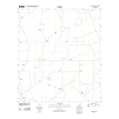
2010 Map of La Pryor NW
USGS Topo · Published 2010About this map
Chaparrosa Ranch dominates the southwestern portion of this Zavala County landscape, where the infrastructure of large-scale Texas ranching is meticulously documented. The presence of the Chaparrosa Ranch Airport and various named water management features like Chaparrosa Lake Dam and Willow Tank Dam underscores the necessity of aviation and water storage in this semi-arid environment. The terrain is defined by the drainage networks of Maverick Creek and Turkey Creek, which are punctuated by a dense system of wind-powered water pumps. These landmarks, including the Turkey Creek Windmill, Comstock Windmill, and Sevenmile Windmill, serve as critical navigational aids across the open range. In the north, Oliphant Ranch sits near the headwaters of Windmill Creek, illustrating the dispersed settlement pattern of the region's historic cattle operations.
Find a feature on this map
38 named features on this map. Tap any name to fly to it.
Don’t see what you’re looking for? This feature index may not catch every label — zoom into the map to look around manually.
Map Details
Editions of this 2010 La Pryor NW Map
This is the sole edition of this map. No revisions or reprints were ever made.
Other maps of this area

1896 · Brackett
USGS Topo · 1:125,000

1897 · Brackett
USGS Topo · 1:125,000

1898 · Uvalde
USGS Topo · 1:125,000

1899 · Uvalde
USGS Topo · 1:125,000

1939 · La Pryor
USGS Topo · 1:62,500

1940 · Chacon Creek
USGS Topo · 1:62,500

1949 · Cline
USGS Topo · 1:62,500

1953 · Crystal City
USGS Topo · 1:250,000

1954 · San Antonio
USGS Topo · 1:250,000

1955 · Crystal City
USGS Topo · 1:250,000