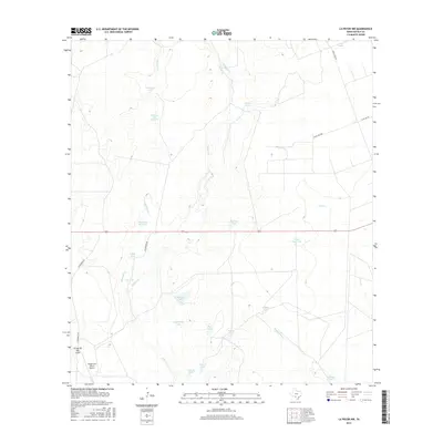
2016 Map of La Pryor NW
USGS Topo · Published 2016About this map
Chaparrosa Ranch Airport and a vast network of water catchment systems characterize this portion of Zavala County. The landscape is defined by its drainage patterns, where intermittent streams like Maverick Cr, Turkey Cr, and Sand Cr feed into an extensive array of named tanks and small lakes. These features, including Watkins Lake Number 2, Chaparrosa Lake, and Caliche Tank, highlight the critical importance of water management for ranching in this South Texas environment. The infrastructure of the area is further marked by rural thoroughfares such as Chaparrosa Rd and Ranch Rd 1986, which connect the remote ranch lands. Large-scale ranching operations are evidenced by the naming conventions of landmarks like Horse Trap Tank and Pepe Tank, reflecting a landscape dedicated to livestock and aviation support.
Find a feature on this map
28 named features on this map. Tap any name to fly to it.
Don’t see what you’re looking for? This feature index may not catch every label — zoom into the map to look around manually.
Map Details
Editions of this 2016 La Pryor NW Map
This is the sole edition of this map. No revisions or reprints were ever made.
Other maps of this area

1896 · Brackett
USGS Topo · 1:125,000

1897 · Brackett
USGS Topo · 1:125,000

1898 · Uvalde
USGS Topo · 1:125,000

1899 · Uvalde
USGS Topo · 1:125,000

1939 · La Pryor
USGS Topo · 1:62,500

1940 · Chacon Creek
USGS Topo · 1:62,500

1949 · Cline
USGS Topo · 1:62,500

1953 · Crystal City
USGS Topo · 1:250,000

1954 · San Antonio
USGS Topo · 1:250,000

1955 · Crystal City
USGS Topo · 1:250,000