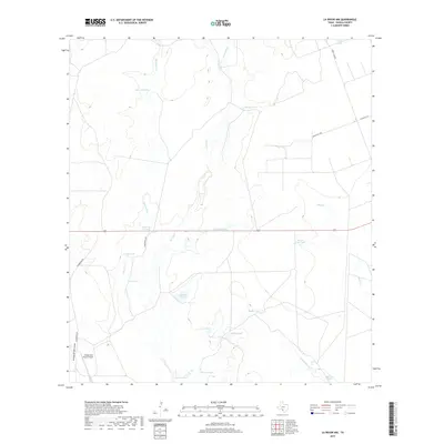
2019 Map of La Pryor NW
USGS Topo · Published 2019About this map
Maverick Cr and Turkey Cr define the drainage patterns across this part of Zavala County, where a complex network of man-made water catchments supports the local ranching economy. This landscape is marked by numerous named tanks, such as Cometa Tank, Pepe Tank, and Horse Trap Tank, illustrating the essential role of water management in this arid South Texas environment. Transportation through the area is facilitated by Green Lake Rd and Chaparrosa Rd, while the Chaparrosa Ranch Airport serves as a notable landmark for regional aviation and large-scale ranch operations. The presence of Arroyo de San Lucas and various seasonal waterways like Sand Cr underscores the intermittent nature of the local hydrography, providing a detailed look at the rural infrastructure of the late 2010s.
Find a feature on this map
26 named features on this map. Tap any name to fly to it.
Don’t see what you’re looking for? This feature index may not catch every label — zoom into the map to look around manually.
Map Details
Editions of this 2019 La Pryor NW Map
This is the sole edition of this map. No revisions or reprints were ever made.
Other maps of this area

1896 · Brackett
USGS Topo · 1:125,000

1897 · Brackett
USGS Topo · 1:125,000

1898 · Uvalde
USGS Topo · 1:125,000

1899 · Uvalde
USGS Topo · 1:125,000

1939 · La Pryor
USGS Topo · 1:62,500

1940 · Chacon Creek
USGS Topo · 1:62,500

1949 · Cline
USGS Topo · 1:62,500

1953 · Crystal City
USGS Topo · 1:250,000

1954 · San Antonio
USGS Topo · 1:250,000

1955 · Crystal City
USGS Topo · 1:250,000