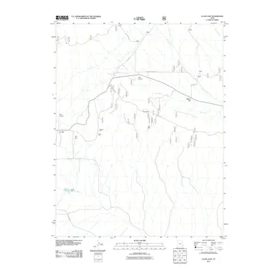
2011 Map of La Sal East
USGS Topo · Published 2011About this map
Old La Sal and its contemporary counterpart La Sal anchor this high-altitude landscape in the La Sal Mountains of San Juan County. The terrain is marked by a legacy of resource extraction, clearly visible through the placement of the Snowball Mine, La Sal Mine, and the Pine Ridge Mine located along Pine Ridge Rd. The map details a complex drainage system where Deer Creek and La Sal Creek cut through the canyons, supplemented by the artificial containment at Wilcox Reservoir and its associated Wilcox Dam. This survey documents the transition between industrial mining sites and open ranching land, connected by a network of specialized routes including La Sal Pass Rd and Ranger Station Rd. Natural landmarks like Doe Canyon and Pole Canyon provide a topographic context for the settlements and workings that have defined this corner of southeastern Utah.
Find a feature on this map
23 named features on this map. Tap any name to fly to it.
Don’t see what you’re looking for? This feature index may not catch every label — zoom into the map to look around manually.
Map Details
Editions of this 2011 La Sal East Map
This is the sole edition of this map. No revisions or reprints were ever made.
Other maps of this area

1885 · La Sal
USGS Topo · 1:250,000

1954 · Mt Peale 1 SE
USGS Topo · 1:24,000

1954 · Mt Peale 1 NE
USGS Topo · 1:24,000

1954 · Mt Peale 4 NE
USGS Topo · 1:24,000

1954 · Mt Peale 4 NW
USGS Topo · 1:24,000

1954 · Mt Peale 3 NE
USGS Topo · 1:24,000

1954 · Mt Peale 1 SW
USGS Topo · 1:24,000

1954 · Mt Peale 1 NW
USGS Topo · 1:24,000

1954 · Mt Peale 2 SE
USGS Topo · 1:24,000

1954 · Mt Peale 2 NE
USGS Topo · 1:24,000