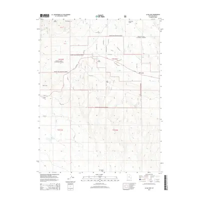
2014 Map of La Sal East
USGS Topo · Published 2014About this map
The high-elevation ranching and mining country of San Juan County is detailed here, centered on the transition between the Manti-Lasal National Forest and the lower basin. La Sal and Old La Sal anchor the human geography, connected by the corridor of State Rte 46 and Ut-46. The landscape is deeply carved by drainage systems like Doe Canyon, Pole Canyon, and Pole Spring Canyon, which channel seasonal runoff toward La Sal Cr and Beaver Cr.
Find a feature on this map
42 named features on this map. Tap any name to fly to it.
Don’t see what you’re looking for? This feature index may not catch every label — zoom into the map to look around manually.
Map Details
Editions of this 2014 La Sal East Map
This is the sole edition of this map. No revisions or reprints were ever made.
Other maps of this area

1885 · La Sal
USGS Topo · 1:250,000

1954 · Mt Peale 1 SE
USGS Topo · 1:24,000

1954 · Mt Peale 1 NE
USGS Topo · 1:24,000

1954 · Mt Peale 4 NE
USGS Topo · 1:24,000

1954 · Mt Peale 4 NW
USGS Topo · 1:24,000

1954 · Mt Peale 3 NE
USGS Topo · 1:24,000

1954 · Mt Peale 1 SW
USGS Topo · 1:24,000

1954 · Mt Peale 1 NW
USGS Topo · 1:24,000

1954 · Mt Peale 2 SE
USGS Topo · 1:24,000

1954 · Mt Peale 2 NE
USGS Topo · 1:24,000