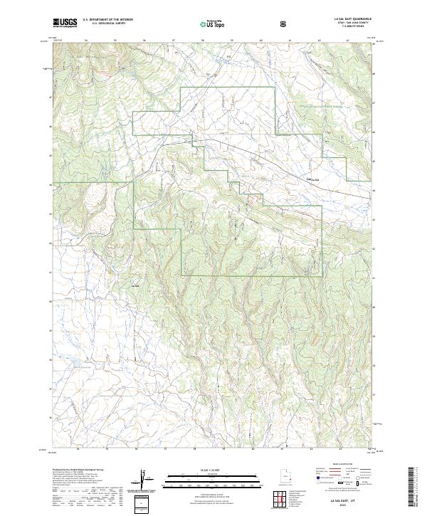
2023 Map of La Sal East
USGS Topo · Published 2023About this map
The La Sal Mountains dominate the northwestern horizon of this high-elevation landscape, where the transition from rugged peaks to timbered plateaus is marked by the boundaries of the Manti-La Sal National Forest. The map documents the relationship between the contemporary settlement of La Sal and the site of Old La Sal to the northeast, connected by a network of rural roads such as Co Rd 124 and La Sal Pass Rd.
Find a feature on this map
33 named features on this map. Tap any name to fly to it.
Don’t see what you’re looking for? This feature index may not catch every label — zoom into the map to look around manually.
Map Details
Editions of this 2023 La Sal East Map
This is the sole edition of this map. No revisions or reprints were ever made.
Other maps of this area

1885 · La Sal
USGS Topo · 1:250,000

1954 · Mt Peale 1 SE
USGS Topo · 1:24,000

1954 · Mt Peale 1 NE
USGS Topo · 1:24,000

1954 · Mt Peale 4 NE
USGS Topo · 1:24,000

1954 · Mt Peale 4 NW
USGS Topo · 1:24,000

1954 · Mt Peale 3 NE
USGS Topo · 1:24,000

1954 · Mt Peale 1 SW
USGS Topo · 1:24,000

1954 · Mt Peale 1 NW
USGS Topo · 1:24,000

1954 · Mt Peale 2 SE
USGS Topo · 1:24,000

1954 · Mt Peale 2 NE
USGS Topo · 1:24,000