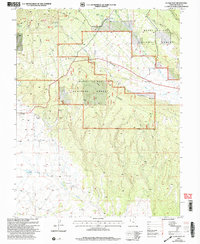
2001 Map of La Sal East
USGS Topo · Published 2004About this map
La Sal and the nearby site of Old La Sal anchor this rugged high-altitude landscape within the Manti-La Sal National Forest. Located in the Moab Ranger District near the Utah-Colorado border, the map highlights the area's transition from agricultural grazing lands to the industrial mining of the early 20th century. Traces of this resource-driven economy are evident in the Snowball Mine and Pandora Mine, situated near the headwaters of La Sal Creek.
Find a feature on this map
33 named features on this map. Tap any name to fly to it.
Don’t see what you’re looking for? This feature index may not catch every label — zoom into the map to look around manually.
Map Details
Editions of this 2001 La Sal East Map
This is the sole edition of this map. No revisions or reprints were ever made.
Other maps of this area

1885 · La Sal
USGS Topo · 1:250,000

1954 · Mt Peale 1 SE
USGS Topo · 1:24,000

1954 · Mt Peale 1 NE
USGS Topo · 1:24,000

1954 · Mt Peale 4 NE
USGS Topo · 1:24,000

1954 · Mt Peale 4 NW
USGS Topo · 1:24,000

1954 · Mt Peale 3 NE
USGS Topo · 1:24,000

1954 · Mt Peale 1 SW
USGS Topo · 1:24,000

1954 · Mt Peale 1 NW
USGS Topo · 1:24,000

1954 · Mt Peale 2 SE
USGS Topo · 1:24,000

1954 · Mt Peale 2 NE
USGS Topo · 1:24,000