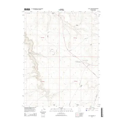
2014 Map of La Sal Junction
USGS Topo · Published 2014About this map
La Sal Junction serves as the focal point for this high-altitude desert landscape in San Juan County, positioned where Us-191 intersects with Ut-46. The terrain is defined by dramatic geological features, including the towering Looking Glass Rock and the extensive plateau of Flat Iron Mesa. These formations are dissected by a network of drainage systems such as Muleshoe Canyon, West Coyote Wash, and Hatch Wash, illustrating the erosional forces that have shaped this portion of southeastern Utah.
Find a feature on this map
27 named features on this map. Tap any name to fly to it.
Don’t see what you’re looking for? This feature index may not catch every label — zoom into the map to look around manually.
Map Details
Editions of this 2014 La Sal Junction Map
This is the sole edition of this map. No revisions or reprints were ever made.
Other maps of this area

1885 · La Sal
USGS Topo · 1:250,000

1954 · Mt Peale 3 NW
USGS Topo · 1:24,000

1954 · Mt Peale 3 NE
USGS Topo · 1:24,000

1954 · Mt Peale 2 SW
USGS Topo · 1:24,000

1954 · Mt Peale 2 NW
USGS Topo · 1:24,000

1954 · Mt Peale 2 SE
USGS Topo · 1:24,000

1954 · Carlisle 1 NE
USGS Topo · 1:24,000

1954 · Carlisle 1 SE
USGS Topo · 1:24,000

1954 · Mt Peale 2 NE
USGS Topo · 1:24,000

1954 · Carlisle 4 NE
USGS Topo · 1:24,000