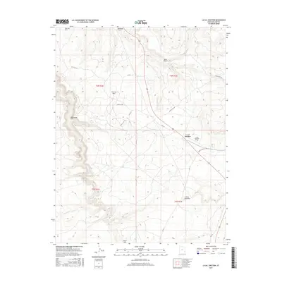
2017 Map of La Sal Junction
USGS Topo · Published 2017About this map
Looking Glass Rock stands as a prominent geological landmark in this high desert landscape of San Juan County, where natural drainages like West Coyote Wash and Hatch Wash carve through the plateau. The small crossroads settlement of La Sal Junction serves as the primary hub for the area, positioned near the La Sal Junction Airport. This 2017 survey details the complex network of backcountry routes, including Browns Hole Rd and Co Rd 131, which provide access to the expansive Flat Iron Mesa and the winding depths of Muleshoe Canyon. The map illustrates a region defined by its hydrography, where seasonal flows like Little Water Cr and Threemile Cr have shaped the terrain between major canyons. For the researcher or traveler, it provides a precise look at the modern road network and named geological features that characterize this corner of Utah.
Find a feature on this map
24 named features on this map. Tap any name to fly to it.
Don’t see what you’re looking for? This feature index may not catch every label — zoom into the map to look around manually.
Map Details
Editions of this 2017 La Sal Junction Map
This is the sole edition of this map. No revisions or reprints were ever made.
Other maps of this area

1885 · La Sal
USGS Topo · 1:250,000

1954 · Mt Peale 3 NW
USGS Topo · 1:24,000

1954 · Mt Peale 3 NE
USGS Topo · 1:24,000

1954 · Mt Peale 2 SW
USGS Topo · 1:24,000

1954 · Mt Peale 2 NW
USGS Topo · 1:24,000

1954 · Mt Peale 2 SE
USGS Topo · 1:24,000

1954 · Carlisle 1 NE
USGS Topo · 1:24,000

1954 · Carlisle 1 SE
USGS Topo · 1:24,000

1954 · Mt Peale 2 NE
USGS Topo · 1:24,000

1954 · Carlisle 4 NE
USGS Topo · 1:24,000