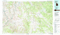
1982 Map of La Sal
USGS Topo · Published 1983About this map
The Colorado River and Green River converge within the iconic sandstone labyrinths of Canyonlands National Park, defining a landscape where extreme erosion has carved features like The Needles and Upheaval Dome. This 1982 survey illustrates the transition from the high alpine environment of the La Sal Mountains down to the arid grabens of Lisbon Valley.
Find a feature on this map
69 named features on this map. Tap any name to fly to it.
Don’t see what you’re looking for? This feature index may not catch every label — zoom into the map to look around manually.
Map Details
Editions of this 1982 La Sal Map
2 editions found
Other maps of this area

1885 · San Rafael
USGS Topo · 1:250,000

1885 · La Sal
USGS Topo · 1:250,000

1886 · Henry Mountains
USGS Topo · 1:250,000

1886 · Abajo
USGS Topo · 1:250,000

1892 · Abajo
USGS Topo · 1:250,000

1892 · Henry Mountains
USGS Topo · 1:250,000

1893 · Abajo
USGS Topo · 1:250,000

1916 · Paradox Valley
USGS Topo · 1:125,000

1922 · Paradox Valley
USGS Topo · 1:125,000

1935 · Elk Ridge
USGS Topo · 1:96,000