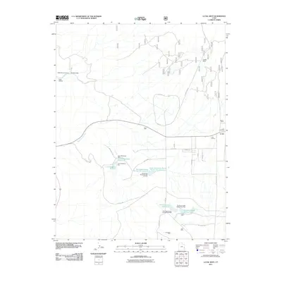
2011 Map of La Sal West
USGS Topo · Published 2011About this map
The settlement of La Sal serves as the focal point for this 2011 survey, situated at the eastern edge of a landscape defined by industrial extraction and high-desert ranching. Evidence of the area's mining history is prominent, featuring the Hecla Shaft, Lisbon Mine, and Alice Mine, alongside the large industrial footprints of the Rio Algom Upper Tailings Pond and Rio Algom Lower Tailings Pond. These sites illustrate the intensive land use required for mineral processing in San Juan County during the early 21st century.
Find a feature on this map
41 named features on this map. Tap any name to fly to it.
Don’t see what you’re looking for? This feature index may not catch every label — zoom into the map to look around manually.
Map Details
Editions of this 2011 La Sal West Map
This is the sole edition of this map. No revisions or reprints were ever made.
Other maps of this area

1885 · La Sal
USGS Topo · 1:250,000

1954 · Mt Peale 3 NW
USGS Topo · 1:24,000

1954 · Mt Peale 4 NW
USGS Topo · 1:24,000

1954 · Mt Peale 3 NE
USGS Topo · 1:24,000

1954 · Mt Peale 1 SW
USGS Topo · 1:24,000

1954 · Mt Peale 1 NW
USGS Topo · 1:24,000

1954 · Mt Peale 2 SW
USGS Topo · 1:24,000

1954 · Mt Peale 2 NW
USGS Topo · 1:24,000

1954 · Mt Peale 2 SE
USGS Topo · 1:24,000

1954 · Mt Peale 2 NE
USGS Topo · 1:24,000