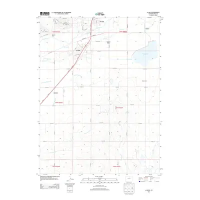
2013 Map of La Salle
USGS Topo · Published 2013About this map
Evans and La Salle anchor this landscape along the S Platte River corridor, where an intricate network of irrigation systems defines the regional development. The engineering of the High Plains is evident in the extensive reach of the Latham Ditch, Union Ditch, and Platte Valley Ditch, which redirect water across the terrain to support local agriculture. This managed water system feeds significant catchments like the Lower Latham Reservoir and Chestnut Reservoir.
Find a feature on this map
68 named features on this map. Tap any name to fly to it.
Don’t see what you’re looking for? This feature index may not catch every label — zoom into the map to look around manually.
Map Details
Editions of this 2013 La Salle Map
This is the sole edition of this map. No revisions or reprints were ever made.
Other maps of this area

1902 · Greeley
USGS Topo · 1:125,000

1949 · Platteville
USGS Topo · 1:24,000

1950 · Greeley
USGS Topo · 1:24,000

1950 · Platteville
USGS Topo · 1:24,000

1950 · Kersey
USGS Topo · 1:24,000

1950 · Bracewell
USGS Topo · 1:24,000

1950 · Milliken
USGS Topo · 1:24,000

1950 · Klug Ranch
USGS Topo · 1:24,000

1950 · Valley View School
USGS Topo · 1:24,000
1950 · Milton Reservoir
USGS Topo · 1:24,000