2022 Map of La Salle
USGS Topo · Published 2022About this map
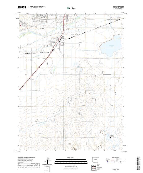
The South Platte River winds through this Colorado landscape, defining a complex network of irrigation that has shaped the agricultural development of Weld County. This U.S. Geological Survey sheet illustrates the intricate water management system essential to the high plains, featuring a dense grid of canals such as the Farmers Independent Ditch, Godfrey Ditch, and Western Mutual Ditch. These waterways support the fields surrounding La Salle and Evans, reflecting a century of engineering designed to harness the river's flow for local farming.
Find a feature on this map
61 named features on this map. Tap any name to fly to it.
Don’t see what you’re looking for? This feature index may not catch every label — zoom into the map to look around manually.
Map Details
Editions of this 2022 La Salle Map
This is the sole edition of this map. No revisions or reprints were ever made.