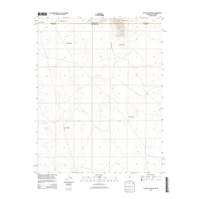
2013 Map of La Segita Peaks NE
USGS Topo · Published 2013About this map
The Colorado New Mexico state line defines the northern boundary of this high-desert territory, where the terrain slopes toward the Punche Valley. This landscape reflects a tradition of water management and livestock movement across the high plains, evidenced by the presence of the Taos Valley Ditch Number 2 cutting through the northern reaches. The area is characterized by open grazing land and survey sections, with the Conejos Co Taos Co line marking the transition between Colorado's Conejos County and New Mexico's Taos County. Settlement here is sparse, with the dirt path of Punche Valley Rd providing the primary access through this borderland region.
Find a feature on this map
9 named features on this map. Tap any name to fly to it.
Don’t see what you’re looking for? This feature index may not catch every label — zoom into the map to look around manually.
Map Details
Editions of this 2013 La Segita Peaks NE Map
This is the sole edition of this map. No revisions or reprints were ever made.
Other maps of this area

1954 · Raton
USGS Topo · 1:250,000

1954 · Trinidad
USGS Topo · 1:250,000

1955 · Trinidad
USGS Topo · 1:250,000

1958 · Raton
USGS Topo · 1:250,000

1958 · Trinidad
USGS Topo · 1:250,000

1959 · Trinidad
USGS Topo · 1:250,000

1963 · Pinabetoso Peaks
USGS Topo · 1:24,000

1963 · Cerro De La Olla
USGS Topo · 1:24,000

1963 · Ute Mountain
USGS Topo · 1:24,000

1963 · Sunshine
USGS Topo · 1:24,000