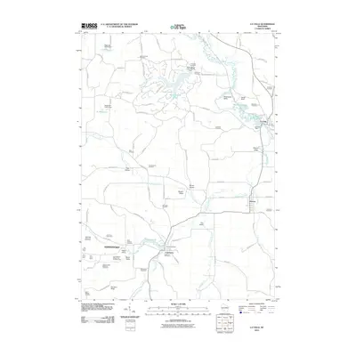
2010 Map of La Valle
USGS Topo · Published 2010About this map
The Baraboo River and Little Baraboo River define the agricultural landscape of this northern Richland County region during the early 21st century. The map documents several established communities, including La Valle, Ironton, and Cazenovia, alongside smaller hamlets like Germantown. A distinctive pattern of naming reflects the area's agricultural heritage, with numerous titled farmsteads such as the Little Valley Dairy and Stock Farm, Elm Grove Farm, and the Baraboo Valley Stock and Dairy Farm explicitly labeled.
Find a feature on this map
104 named features on this map. Tap any name to fly to it.
Don’t see what you’re looking for? This feature index may not catch every label — zoom into the map to look around manually.
Map Details
Editions of this 2010 La Valle Map
This is the sole edition of this map. No revisions or reprints were ever made.
Other maps of this area

1905 · Richland Center
USGS Topo · 1:125,000

1927 · Hillsboro
USGS Topo · 1:62,500

1956 · Reedsburg
USGS Topo · 1:62,500

1958 · La Crosse
USGS Topo · 1:250,000

1960 · Richland Center
USGS Topo · 1:62,500

1960 · Plain
USGS Topo · 1:62,500

1961 · La Crosse
USGS Topo · 1:250,000

1965 · La Crosse
USGS Topo · 1:250,000

1966 · Hillsboro
USGS Topo · 1:62,500
1975 · Wonewoc
USGS Topo · 1:24,000