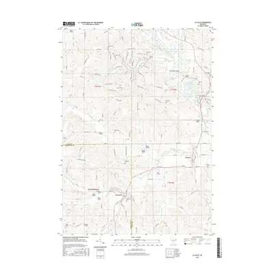
2016 Map of La Valle
USGS Topo · Published 2016About this map
La Valle and Ironton anchor this portion of the Wisconsin driftless area, where the Baraboo River and Little Baraboo River carve through a landscape of named ridges and hollows. The presence of La Valle Mill Pond and Hemlock Slough highlights the historic reliance on local waterpower and the natural drainage patterns of the region. To the south, Cazenovia sits near the junction of Lee Lake and several smaller tributaries like McGlynn Cr. Genealogists will find a high density of small burial grounds tucked into the hills, including Solchenberger Cem, Karstetter Cem, and Saints Anthony Cem near Germantown. The map clearly delineates the Sauk Co Richland Co border, showing how the rural road network and township boundaries were influenced by the underlying topography of features like Harrison Ridge and Buckwheat Valley.
Find a feature on this map
124 named features on this map. Tap any name to fly to it.
Don’t see what you’re looking for? This feature index may not catch every label — zoom into the map to look around manually.
Map Details
Editions of this 2016 La Valle Map
This is the sole edition of this map. No revisions or reprints were ever made.
Other maps of this area

1905 · Richland Center
USGS Topo · 1:125,000

1927 · Hillsboro
USGS Topo · 1:62,500

1956 · Reedsburg
USGS Topo · 1:62,500

1958 · La Crosse
USGS Topo · 1:250,000

1960 · Richland Center
USGS Topo · 1:62,500

1960 · Plain
USGS Topo · 1:62,500

1961 · La Crosse
USGS Topo · 1:250,000

1965 · La Crosse
USGS Topo · 1:250,000

1966 · Hillsboro
USGS Topo · 1:62,500
1975 · Wonewoc
USGS Topo · 1:24,000