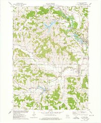
1975 Map of La Valle
USGS Topo · Published 1978About this map
The Baraboo River and the Chicago and North Western railroad corridor shape the landscape of this mid-1970s survey. Significant water features like Dutch Hollow Lake and the La Valle Mill Pond indicate a region shaped by both natural drainage and deliberate hydrologic engineering for local use. The map captures a densely documented social geography, with numerous family and community burial grounds such as Solchenberger Cem, Oaks Cem, and Thornton Cem scattered across the township boundaries.
Find a feature on this map
63 named features on this map. Tap any name to fly to it.
Don’t see what you’re looking for? This feature index may not catch every label — zoom into the map to look around manually.
Map Details
Editions of this 1975 La Valle Map
This is the sole edition of this map. No revisions or reprints were ever made.
Other maps of this area

1905 · Richland Center
USGS Topo · 1:125,000

1927 · Hillsboro
USGS Topo · 1:62,500

1956 · Reedsburg
USGS Topo · 1:62,500

1958 · La Crosse
USGS Topo · 1:250,000

1960 · Richland Center
USGS Topo · 1:62,500

1960 · Plain
USGS Topo · 1:62,500

1961 · La Crosse
USGS Topo · 1:250,000

1965 · La Crosse
USGS Topo · 1:250,000

1966 · Hillsboro
USGS Topo · 1:62,500
1975 · Wonewoc
USGS Topo · 1:24,000