
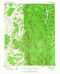
1939 Map of La Ventana
USGS Topo · Published 1957About this map
Señorita and La Ventana anchor the western flats of this late 1930s landscape, where the arid drainage of the Río Puerco meets the rising timber of the Santa Fe National Forest. The geography reveals a transition from livestock ranching and small-scale mining in the valley to seasonal logging operations in the high country. Resource extraction is evident at the Luciani Mines and the San Miguel Mine, while local education is represented by scattered outposts like the Gonzalitos Sch and San Miguel Sch. In the mountains to the east, the timber economy is marked by the Ojitos Logging Camp and O'Neil Landing, supported by forest management infrastructure such as the Blue Bird Ranger Station and the Rio de las Vacas Ranger Cabin. The complex network of canyons, including San Miguel Canyon and Señorita Canyon, defines the rugged movement of water toward the Rio Puerco basin.
Find a feature on this map
64 named features on this map. Tap any name to fly to it.
Don’t see what you’re looking for? This feature index may not catch every label — zoom into the map to look around manually.
Map Details
Editions of this 1939 La Ventana Map
2 editions found
Other maps of this area

1883 · Mt. Taylor
USGS Topo · 1:250,000

1886 · Mt. Taylor
USGS Topo · 1:250,000

1889 · Largo
USGS Topo · 1:250,000

1890 · Jemes
USGS Topo · 1:125,000

1892 · Jemes
USGS Topo · 1:125,000

1892 · Mt. Taylor
USGS Topo · 1:250,000

1895 · Largo
USGS Topo · 1:250,000

1899 · Mt. Taylor
USGS Topo · 1:250,000

1909 · Gallina
USGS Topo · 1:125,000

1937 · Jemez Springs
USGS Topo · 1:48,000