
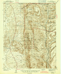
1943 Map of La Ventana
USGS Topo · Published 1943About this map
Santa Fe National Forest dominates the rugged landscape of this 1943 edition, revealing the working wilderness of the San Miguel Mountains. The industrial and educational foundations of the area are evident in the placement of the Luciani Mines and the Copper City Sch, alongside smaller settlements like Señorita and La Ventana. The map captures a moment when resource extraction and forest management were the primary drivers of local geography, marked by sites such as the Ojitos Logging Camp and the Blue Bird Ranger Station. To the south, the extensive Ojo Del Espiritu Santo land grant meets the drainage of the Rio Puerco, providing a clear look at the historic land divisions and remote outpost schools like Gonzalitos Sch that served this isolated portion of Sandoval County.
Find a feature on this map
53 named features on this map. Tap any name to fly to it.
Don’t see what you’re looking for? This feature index may not catch every label — zoom into the map to look around manually.
Map Details
Editions of this 1943 La Ventana Map
2 editions found
Other maps of this area

1883 · Mt. Taylor
USGS Topo · 1:250,000

1886 · Mt. Taylor
USGS Topo · 1:250,000

1889 · Largo
USGS Topo · 1:250,000

1890 · Jemes
USGS Topo · 1:125,000

1892 · Jemes
USGS Topo · 1:125,000

1892 · Mt. Taylor
USGS Topo · 1:250,000

1895 · Largo
USGS Topo · 1:250,000

1899 · Mt. Taylor
USGS Topo · 1:250,000

1909 · Gallina
USGS Topo · 1:125,000

1937 · Jemez Springs
USGS Topo · 1:48,000