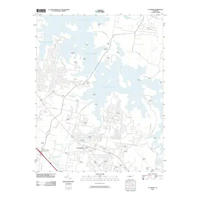
2010 Map of La Vergne
USGS Topo · Published 2010About this map
J Percy Priest Reservoir dominates the northern half of this landscape, its expansive waters creating a complex shoreline that includes the Poole Knobs Recreation Area. The southern portion of the sheet transitions into the growing urban infrastructure of La Vergne, where residential developments are interspersed with deep-rooted family history. The sheer number of small burial grounds, such as Castleman-Bruer Cemetery, Richeson Cemetery, and Morrow Cemetery, points to the area's agricultural past before the reservoir's creation and subsequent suburban expansion. In the southeast, the large-scale industrial presence of the Smyrna Airport and the Smyrna Golf Course contrasts with the natural drainage of Hurricane Creek and Finch Branch. This 2010 survey provides a clear look at the intersection of modern recreation and legacy land use in Davidson County.
Find a feature on this map
83 named features on this map. Tap any name to fly to it.
Don’t see what you’re looking for? This feature index may not catch every label — zoom into the map to look around manually.
Map Details
Editions of this 2010 La Vergne Map
This is the sole edition of this map. No revisions or reprints were ever made.
Other maps of this area

1903 · Nashville
USGS Topo · 1:125,000

1916 · Murfreesboro
USGS Topo · 1:62,500

1932 · Hermitage
USGS Topo · 1:62,500

1942 · Lebanon
USGS Topo · 1:100,000

1950 · Walterhill
USGS Topo · 1:24,000

1951 · Martha
USGS Topo · 1:24,000

1952 · Hermitage
USGS Topo · 1:24,000

1952 · La Vergne
USGS Topo · 1:24,000

1952 · Nashville East
USGS Topo · 1:24,000

1952 · Antioch
USGS Topo · 1:24,000