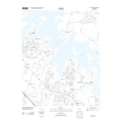
2013 Map of La Vergne
USGS Topo · Published 2013About this map
The J Percy Priest Reservoir dominates the landscape of this 2013 survey, its irregular shoreline reaching into the residential and suburban developments east of Nashville. Several established neighborhoods and named locales, such as Couchville, Smith Springs, and Morrow, sit along the reservoir's edges, reflecting the area's growth around this major water feature. To the south and west, a dense network of suburban streets and industrial corridors, including Threet Industrial Blvd and the Jefferson Pike area, shows the transition from the lakeside recreation of Priest Lake Park to the commercial expansion near the Smyrna border.
Find a feature on this map
221 named features on this map. Tap any name to fly to it.
Don’t see what you’re looking for? This feature index may not catch every label — zoom into the map to look around manually.
Map Details
Editions of this 2013 La Vergne Map
This is the sole edition of this map. No revisions or reprints were ever made.
Other maps of this area

1903 · Nashville
USGS Topo · 1:125,000

1916 · Murfreesboro
USGS Topo · 1:62,500

1932 · Hermitage
USGS Topo · 1:62,500

1942 · Lebanon
USGS Topo · 1:100,000

1950 · Walterhill
USGS Topo · 1:24,000

1951 · Martha
USGS Topo · 1:24,000

1952 · Hermitage
USGS Topo · 1:24,000

1952 · La Vergne
USGS Topo · 1:24,000

1952 · Nashville East
USGS Topo · 1:24,000

1952 · Antioch
USGS Topo · 1:24,000