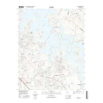
2016 Map of La Vergne
USGS Topo · Published 2016About this map
J Percy Priest Reservoir dominates the northern landscape of this region where Davidson, Wilson, and Rutherford counties meet. The reservoir's irregular shoreline surrounds several small communities, including Couchville and Rural Hill, while the southern half of the sheet is defined by the suburban and industrial expansion of La Vergne and Smyrna. For genealogists, the map is remarkably dense with family burial grounds, preserving the locations of the Castleman-Bruer Cem, Tilgham Cem, and Holloway Cem, among many others. The infrastructure of the Smyrna Airport and the historical corridor of Murfreesboro Rd illustrate the transit-driven development that has shaped this corridor between Nashville and Murfreesboro.
Find a feature on this map
71 named features on this map. Tap any name to fly to it.
Don’t see what you’re looking for? This feature index may not catch every label — zoom into the map to look around manually.
Map Details
Editions of this 2016 La Vergne Map
This is the sole edition of this map. No revisions or reprints were ever made.
Other maps of this area

1903 · Nashville
USGS Topo · 1:125,000

1916 · Murfreesboro
USGS Topo · 1:62,500

1932 · Hermitage
USGS Topo · 1:62,500

1942 · Lebanon
USGS Topo · 1:100,000

1950 · Walterhill
USGS Topo · 1:24,000

1951 · Martha
USGS Topo · 1:24,000

1952 · Hermitage
USGS Topo · 1:24,000

1952 · La Vergne
USGS Topo · 1:24,000

1952 · Nashville East
USGS Topo · 1:24,000

1952 · Antioch
USGS Topo · 1:24,000