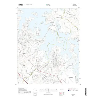
2019 Map of La Vergne
USGS Topo · Published 2019About this map
The sprawling waters of the J Percy Priest Reservoir dominate this 2019 survey, illustrating the modern geography of the Davidson and Rutherford county lines. The town of La Vergne sits at the heart of a residential landscape that has grown around natural features like Hurricane Creek and the Sinking Creek drainage. For genealogists, the map is a vital record of numerous small family burial grounds that persist amidst modern development, including Boner Cem, Richeson Cem, and Castleman-Bruer Cem. The industrial and transportation footprint is anchored by the Smyrna Airport in the southeast, while the northern reaches provide recreational access through the Volunteer Trail and the preserved waters of Couchville Lake. This map captures a suburban Tennessee landscape defined by the balance between its agrarian past and its contemporary role as a residential hub near Nashville.
Find a feature on this map
266 named features on this map. Tap any name to fly to it.
Don’t see what you’re looking for? This feature index may not catch every label — zoom into the map to look around manually.
Map Details
Editions of this 2019 La Vergne Map
This is the sole edition of this map. No revisions or reprints were ever made.
Other maps of this area

1903 · Nashville
USGS Topo · 1:125,000

1916 · Murfreesboro
USGS Topo · 1:62,500

1932 · Hermitage
USGS Topo · 1:62,500

1942 · Lebanon
USGS Topo · 1:100,000

1950 · Walterhill
USGS Topo · 1:24,000

1951 · Martha
USGS Topo · 1:24,000

1952 · Hermitage
USGS Topo · 1:24,000

1952 · La Vergne
USGS Topo · 1:24,000

1952 · Nashville East
USGS Topo · 1:24,000

1952 · Antioch
USGS Topo · 1:24,000