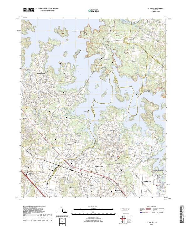
2022 Map of La Vergne
USGS Topo · Published 2022About this map
J Percy Priest Reservoir dominates the northern reaches of this landscape, its irregular shoreline creating a complex of islands and inlets where the Stones River once flowed. The area reflects a transition from rural crossroads to suburban development between Nashville and Smyrna. Dense residential networks in La Vergne and Eastwood contrast with the large industrial footprint of CSX Transportation and the Smyrna Airport to the southeast. Genealogists will find a high concentration of family burial grounds scattered throughout the quadrangle, including the Castleman - Bruer Cem, Gambill Forrester Cem, and the Painter Family Cem. These sites, alongside landmarks like Smith Springs Ch and the historic settlement area of Couchville, provide essential reference points for tracing the lineage of families who inhabited this portion of Rutherford and Davidson Counties.
Find a feature on this map
284 named features on this map. Tap any name to fly to it.
Don’t see what you’re looking for? This feature index may not catch every label — zoom into the map to look around manually.
Map Details
Editions of this 2022 La Vergne Map
This is the sole edition of this map. No revisions or reprints were ever made.
Other maps of this area

1903 · Nashville
USGS Topo · 1:125,000

1916 · Murfreesboro
USGS Topo · 1:62,500

1932 · Hermitage
USGS Topo · 1:62,500

1942 · Lebanon
USGS Topo · 1:100,000

1950 · Walterhill
USGS Topo · 1:24,000

1951 · Martha
USGS Topo · 1:24,000

1952 · Hermitage
USGS Topo · 1:24,000

1952 · La Vergne
USGS Topo · 1:24,000

1952 · Nashville East
USGS Topo · 1:24,000

1952 · Antioch
USGS Topo · 1:24,000